
Dublin Neighbor Sources Around a Block
A Dublin neighbor lookup is a chain of sources with different custodians. GIS answers where parcels sit. The Assessor is the controlled route for owner information. Recorded documents show named parties after an owner or instrument clue is known. Permits show projects and roles. Neighborhood Watch keeps a voluntary contact layer, while voter information is purpose-limited rather than a block browse.
| Source | What It Shows About a Block | Access |
|---|---|---|
| Dublin GIS and parcel layer | Adjacent polygons, APNs, situs and mailing fields, building facts, and latest document identifiers | Public map and REST service; no owner names; non-survey |
| Alameda County Assessor | Owner, exemption, value, parcel, and assessment information | Offline, kiosk, phone, email, or written request |
| Clerk-Recorder | Deeds, liens, easements, maps, and named document parties | Name or instrument search; no street browse or remote images |
| Dublin permits and address files | Project, applicant, contractor, inspection, and address-assignment clues | CSS, City files, or focused CPRA request |
| Neighborhood Watch | Voluntary block contacts and group-held details | Private roster; City helps locate a contact |
| Voter file | Approved-purpose registration data, not a public block list | Self-service or controlled request under California law |
Ownership is not occupancy. Mailing and situs addresses answer different questions, and a permit contact can be an applicant, developer, or contractor. The strongest Dublin neighbors result keeps each role labeled instead of collapsing every name attached to a parcel into a household.
Map a Dublin Block From One Address
The Dublin GIS viewer searches addresses, parcels, schools, parks, streets, and other features. Turn on the Parcels or Address Grid layers, use the map browse tools, and click the polygons that share a boundary or sit across the street. The viewer supports export, print, and share functions, but its data are continuously maintained and are not a legal survey.
- Search the starting address or APN and confirm the mapped situs.
- Enable parcel and address layers, then pan and zoom around the starting polygon.
- For each adjacent parcel, record the APN, situs, mailing, building, and latest-document fields.
- Use the Assessor’s permitted offline route if an owner name is needed.
- Move to the recorder, permits, or Neighborhood Watch only when the question fits that custodian.
The parcel REST service supports a distance query, pagination, and export. No consumer-facing radius button was verified, so a block search should not promise an automatic radius result. For a whole named street rather than nearby polygons, use the Dublin street directory address chain.
Dublin Parcel Fields for Neighbor Research
The Dublin city-limit parcel result is rich in geography even though owner names are suppressed. It can place a parcel, identify the document trail to ask for, and show how the mapped property relates to the next polygon. It can also expose differences between where assessment mail goes and where the parcel sits.
| Field group | Examples in the parcel result | Use and limit |
|---|---|---|
| Parcel identity | APN, APN_SORT, BOOK, PAGE, PARCEL, SUB_PARCEL | Matches the map to an Assessor or recorder inquiry |
| Location | SitusAddress, situs ZIP+4, MailingAddress, mailing ZIP and ZIP+4 | Separates mapped place from assessment correspondence |
| Latest document | LatestDocument_Prefix, LatestDocumentSeries, LatestDocumentDate | Prepares a recorder search; not the document image |
| Assessment | Land, improvements, HOEX, OTEX, total net value, use and class | Describes the parcel; does not name a household |
| Physical building | Effective year, year built, area, lot size, stories, rooms, beds, baths, and units | Helps compare adjacent parcels; not proof of people present |
HOEX can support an owner-occupancy inference, but it does not identify a household. A mailing address outside Dublin may signal that the owner and the mapped occupant are different, yet it still does not identify the people present. Treat every field as a clue with a defined scope.
Dublin Owner Names Need an Offline Step
Alameda County deliberately omits owner names from the public web property layer. The Assessor’s permitted channels include a limited parcel lookup by phone at 510-272-3787, email at AssessorWebResponse@acgov.org, a written ownership request, or the public kiosk at 1221 Oak Street, Room 145, Oakland, Monday through Friday from 9:00 a.m. to 4:30 p.m. The Dublin satellite at 7600 Dublin Boulevard, Suite 270 provides full Assessor service for east and south county.
Bring the address or APN and explain the record question. A kiosk result can connect a parcel with an owner and assessment facts, while supporting ownership statements, exemption claims, preliminary change forms, business-property statements, construction costs, income data, and assessor comparables have their own confidentiality limits. The offline step is part of the design, not a missing GIS feature.
The Alameda Property Search is still useful at the start because its address autocomplete resolves a parcel, even when it does not display the owner online.
Dublin Permits Show Projects, Not Households
Dublin Citizen Self-Service, or CSS, launched July 5, 2024 for building and Public Works permits, planning applications, fire permits, and business licenses. Published actions include submission, payment, progress tracking, inspection scheduling, inspection results or approvals, and document exchange. Categories include Permits, Plans, and Licenses, with an All option. These records can show a project at a parcel and the applicant, developer, contractor, or inspection role connected to it. They do not establish who lives there.
For older work, request legacy records through the City Clerk or a focused CPRA request. Public Works files include amended maps, certificates of correction or compliance, grants of deed or easement, mergers, parcel-map waivers, single-parcel reviews, final or parcel maps, warranty closeout, and street vacation or abandonment. Address applications can bridge a tract or APN to a final street number. Preserve the role attached to every contact.
The City’s permit forms and applications page shows the municipal record route used for local permits and related forms.
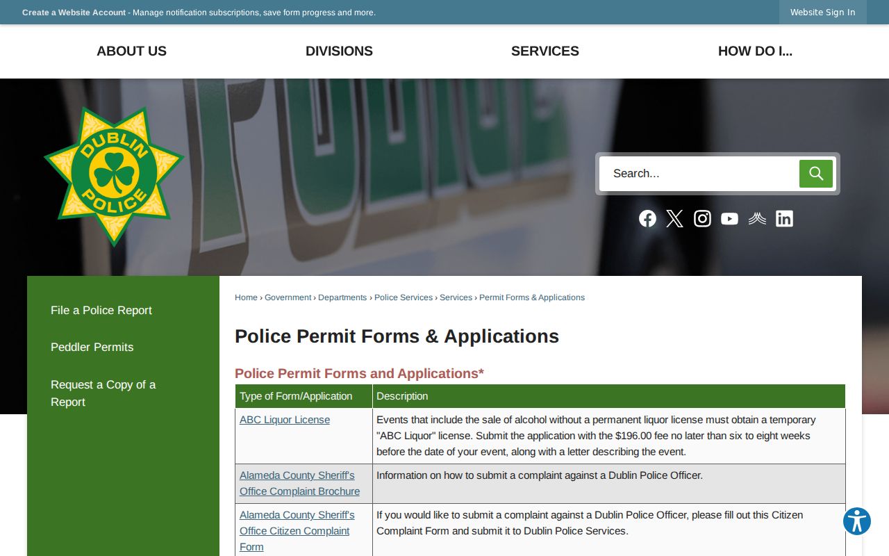
The permit image belongs in a parcel trail because it points to official forms, while the person attached to a form still needs role and custodian checks.
Dublin Neighborhood Watch Contacts Are Voluntary
Neighborhood Watch is Dublin’s verified community-directory layer. Each group elects a Block Contact and Co-Contact. The City keeps active-contact information and helps residents locate a contact through Crime Prevention at 925-833-6686, but it does not publish a household roster. A contact list belongs to the voluntary group that keeps it.
Block Contact
Primary voluntary point for a participating street or block. City staff may help a resident locate the contact.
Block Co-Contact
Second voluntary point for the same group. The role is a community contact, not a public list of every neighbor.
Crime Prevention
925-833-6686. Use this City channel to ask how to locate an active Neighborhood Watch contact.
The blank voluntary roster asks for street name, address, name, home or cell number, email, children’s name, age, and sex, plus vehicle make, model, color, year, and license. Those details are sensitive group-held information. They are not an official public resident directory and should not be copied into a wider block list.
Dublin Voter Data Is Not a Block Browse
California Secretary of State My Voter Status and Alameda My Voter Profile are authenticated self-lookups. They can return a voter’s registration status, party preference, vote-by-mail status, polling place, and election materials or status. They do not provide a personal by-street browse. The state’s rules specifically reject a request for voters living on a certain street in a certain city as a specific-voter request.
Elections Code §2194 limits voter information to election, scholarly, journalistic, political, governmental, or record-review purposes. Government Code §7924.000 protects confidential fields. A controlled file request requires applicant identity, organization and purpose, security details, and an agreement not to transfer or misuse the data. Safe at Home participants can register confidentially through 877-322-5227. The voter file is therefore a privacy boundary around Dublin neighbors, not a missing GIS layer.
The Alameda Registrar of Voters provides the county election source behind the self-service and controlled-access routes.
The election image reinforces the distinction between checking one voter’s status and browsing a block for names.
Dublin Blocks Cross More Than One Boundary
Dublin records cross county, city, postal, planning-area, and federal Camp Parks boundaries. A parcel inside the city-limit map can have a mailing address that answers a different geographic question, while a planning reference can reach beyond the incorporated city. The 1982 incorporation, 1986 Camp Parks annexation, western additions through 1991, and eastern growth from 1995 are useful clues when a block’s older records appear under county or federal custodians.
The GIS HOA layer can identify association coverage, but research found no official comprehensive named HOA or member inventory. The Dublin Chamber community guide identifies businesses and organizations, not households. Neighborhood Watch contacts are voluntary and private. These community layers help explain who may organize around a block without becoming a list of every person nearby.
Note: A mapped association boundary identifies coverage, not membership, and a postal or planning label does not replace the parcel’s legal jurisdiction.
Official Dublin Sources and Commercial Neighbor Tools
Official sources are narrower, but their limits are visible. Commercial compilation tools may combine public, licensed, and inferred data, then present a broad result without showing which custodian supplied each field. Both categories require care, yet only the official custodian can confirm or correct its own record.
| Source category | Useful clue | Limit to keep in view |
|---|---|---|
| Dublin GIS | Adjacent parcel shape, APN, situs, mailing, building, and latest document fields | No owner names; dynamic map; not a legal survey |
| Assessor and recorder | Controlled ownership route and named deed parties | Offline owner access, name-based recorder search, and office-only images |
| City permits | Project, applicant, contractor, inspection, and address clues | A role on a permit does not prove occupancy |
| Neighborhood Watch | Voluntary contact for a participating block | Private roster; no public household list |
| Commercial compilations | Broad lead assembled from multiple data sources | May be stale, merge namesakes, or omit protected changes |
Use the category that fits the question, save the source date, and verify with the agency or group that owns the record. A broad compilation cannot override a sealed record, a confidential voter field, or a correction made by an official custodian.
Privacy Limits on Dublin Neighbors
The CCPA and CPRA, Civil Code §1798.100 and following, give qualifying business-data rights to know, access, delete with exceptions, correct, limit sensitive-data use, and opt out of sale or sharing. Those rights do not require a government office to erase a lawful deed, case, parcel, or voter record. California DROP begins August 1, 2026 for registered brokers processing verified deletion requests, but removing a copy from a broker does not rewrite its source.
Safe at Home can shield eligible participants with a substitute mailing address, confidential voter registration, mail forwarding, and certain name or DMV protections. The federal Driver’s Privacy Protection Act, 18 U.S.C. §§2721 through 2725, limits DMV personal information. California Penal Code §646.9 addresses stalking, Civil Code §1708.7 provides a civil stalking remedy, and Code of Civil Procedure §527.6 provides a civil-harassment restraining-order route.
Lawful use. Use Dublin neighbor information for personal, lawful block awareness and civic research. Do not use a parcel, contact, voter, or group record to stalk, surveil, harass, intimidate, or harm anyone.
A good neighbor lookup ends where the record ends. Respect a protected address, keep voluntary contact details private, and ask the custodian for a correction instead of assembling a substitute list.