
Dublin ZIP Code Coverage
Research verifies one standard ZIP directly serving Dublin: 94568. It covers incorporated Dublin and a postal delivery area, so the postal label still needs a parcel-by-parcel city-limit check. The Dublin ZIP code directory should therefore begin with the single verified row rather than add nearby postal codes that have not been verified as Dublin ZIPs.
| ZIP | Areas Covered | Post Office | Notes |
|---|---|---|---|
| 94568 | Incorporated Dublin plus its postal delivery area | 6937 Village Pkwy, Dublin CA 94568-2405 | Sole verified standard Dublin ZIP; not PO-box-only or unique |
A ZIP code is not a county, city, planning area, or legal parcel. Postal coverage can cross a municipal edge, and a city planning map is broader than the incorporated boundary. The safest directory practice is to verify the ZIP with USPS, then use Dublin’s city-limit parcel layer for the exact property.
The USPS city and state lookup is the source used to confirm the Dublin postal entry. Its result is a routing check, not a resident search.
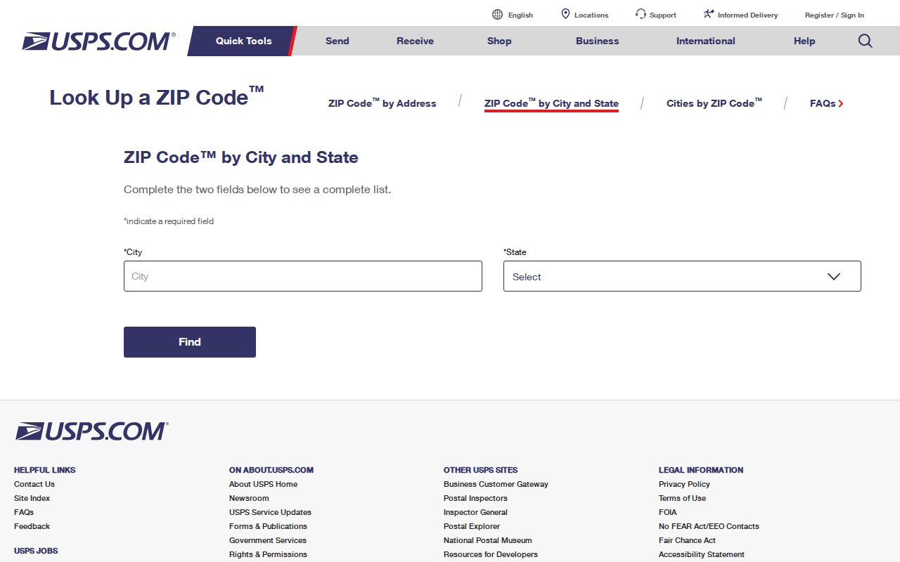
The USPS capture shows the right first step: confirm the postal city and ZIP before comparing a parcel with Dublin’s municipal map.
The Dublin Post Office for ZIP 94568
The Dublin Post Office is at 6937 Village Parkway, Dublin, California 94568-2405, with phone number 925-828-2689. Retail hours are Monday through Friday from 9:30 a.m. to 5:00 p.m. and Saturday from 10:00 a.m. to 2:00 p.m. PO Box access runs Monday through Friday from 8:30 a.m. to 5:30 p.m. and Saturday from 8:00 a.m. to 3:00 p.m.
This facility matters to Dublin postal research because it confirms the local routing anchor and the type of ZIP in use. Research does not classify 94568 as PO-box-only or unique. That distinction prevents a post-office address from being mistaken for a separate postal jurisdiction or for a list of people who receive mail there.
The USPS location detail supplies the facility record behind the hours and address.
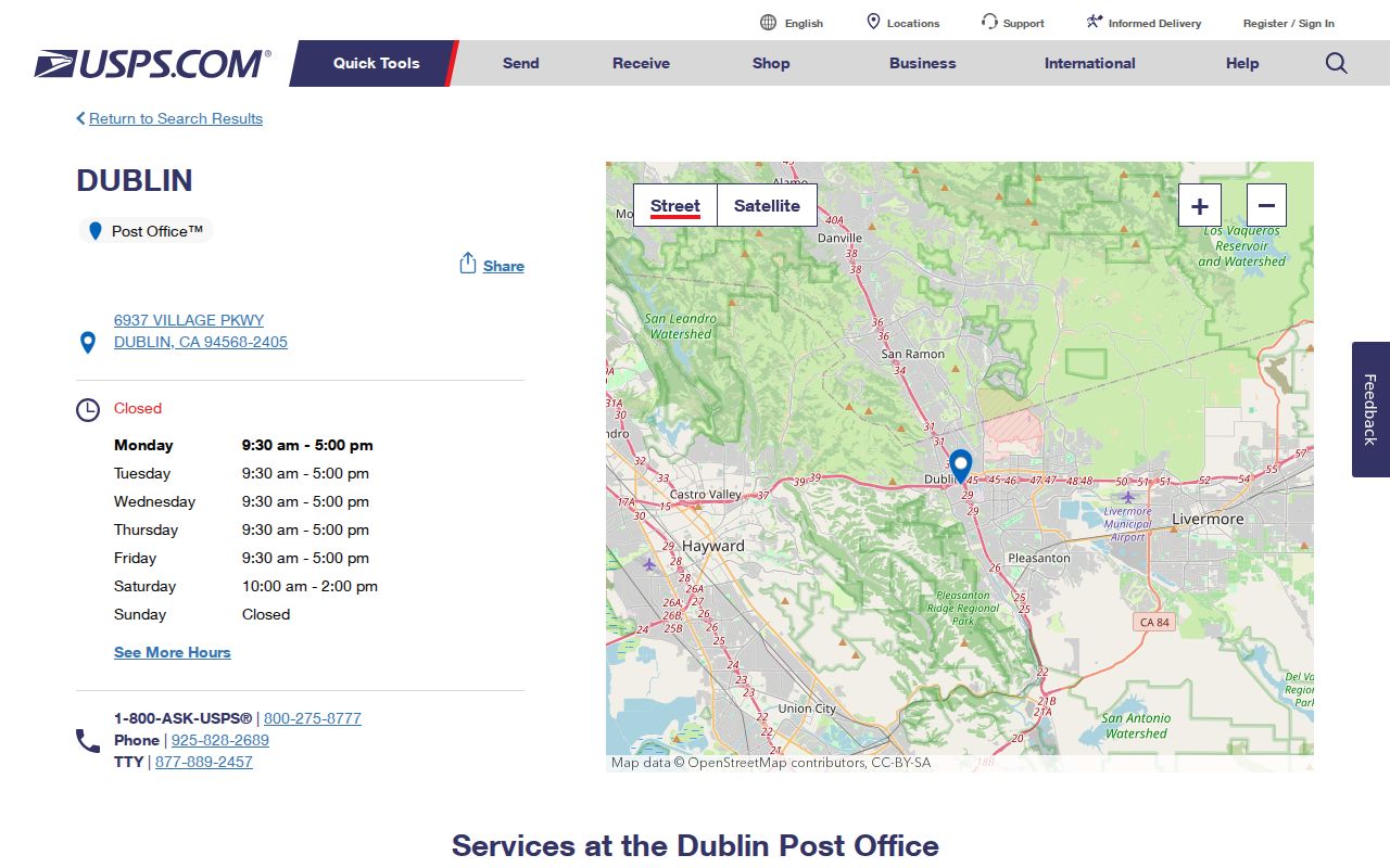
The location detail is useful for postal verification, while parcel, assessor, and city records remain the sources for land and civic geography.
Dublin ZIP Code Portal Limits
The key fact for Dublin postal research is negative: no official portal found in the research offers a ZIP-wide resident search. The Assessor and tax systems use address or parcel input, not ZIP. The recorder searches party name, instrument, date, and document type, with no ZIP input. The voter file has no public ZIP browse and is purpose-limited. Dublin GIS can query parcel geography and ZIP+4 fields, but it is not a named resident roll.
The available fields show why a ZIP code cannot be dropped into every search box. Use a structured parcel or address query, then ask the appropriate custodian for the next record. The GIS REST service is the closest geography tool, with distance query, pagination, export, and a maximum of 1,000 features.
| Portal or field | Actual available input | Effect on ZIP search |
|---|---|---|
| Assessor Parcel Number | Radio plus text; format like 123-345-67 | One parcel mode; no ZIP field |
| Type Ahead or Property Address | Radio plus autocomplete; select a standardized suggestion | One address mode; no ZIP-wide list |
| Tax search tabs | Address or Parcel Number, each using autocomplete | Searches a selected address or APN, not ZIP |
| Dublin GIS universal search | Address, parcel, school, park, or street autocomplete | Map geography without a consumer ZIP button |
| Parcel REST query | Structured and distance queries; ZIP+4 fields in results | Closest ZIP geography; export is capped at 1,000 features |
The Dublin parcel REST layer exposes SitusZip_4, MailingAddressZip, and ZIP+4 data, along with APN, document, building, and mailing fields. Those fields help sort parcels. They do not reveal owner names or household membership.
Narrowing a Dublin Resident Search by ZIP
A ZIP search is a staged parcel workflow. It can narrow geography, but it cannot make every record keeper answer by ZIP. Use the postal lookup for the label, city GIS for the boundary test, and the Assessor or other custodian only after the parcel is known.
- Confirm Dublin and 94568 with the USPS city and state lookup.
- Open the Dublin GIS viewer, search an address or parcel, and turn on the city-limit parcel layer.
- Read the APN, situs address, mailing address, ZIP+4, latest document identifiers, and physical parcel fields. Use export or pagination only as a working geographic set.
- Use Alameda County Assessor Property Assessment Information or the tax portal for a specific address or APN. Neither exposes a ZIP-wide owner search.
- For a person or event, pivot to the correct record custodian. Voter data requires an approved purpose, and a CPRA request seeks existing records rather than a new ZIP roster.
Once a ZIP narrows the map to a street, the address-keyed chain belongs in the Dublin street directory workflow. That next step keeps ZIP geography from being confused with a named street or a current occupant.
Four Dublin Address Keys at One Parcel
A single Dublin property can carry four identifiers. The deed’s legal description describes the land in the recorded instrument. The Assessor’s APN identifies the tax parcel. The city-approved situs address identifies the mapped location. The USPS mailing city and ZIP route delivery. These keys can point to one place while answering different questions.
Assessor and tax searches accept a parcel number with dashes and no leading zeroes, such as 123-345-67, or a standardized address suggestion. The GIS layer separates BOOK, PAGE, PARCEL, and SUB_PARCEL fields and also separates SitusAddress from MailingAddress. The recorder does not search by address or APN, so a name or instrument is needed after the parcel clue is found.
- ZIP code
- A postal routing label. It does not establish a city limit or identify every person receiving mail there.
- City limit
- The incorporated Dublin boundary tested with the city-limit parcel layer, separate from postal routing.
- ZIP+4
- The extra four-digit delivery suffix stored with the parcel’s situs or mailing ZIP fields.
- PO-box ZIP
- A postal code used chiefly for post-office box delivery. Research does not classify 94568 this way.
- Unique ZIP
- A code assigned to one institution or delivery point. Research does not classify 94568 as unique.
- Carrier route
- A delivery grouping inside postal service geography, not a municipal boundary or parcel ownership field.
Keeping the four keys apart is the main safeguard in ZIP code research. A mailing address can be off-site, and a situs address can identify land without identifying who is present.
Dublin ZIP Code and City Limits
Postal and municipal geography overlap in Dublin but are not interchangeable. The city-limit parcel service can test whether a mapped parcel lies inside the incorporated city. Dublin’s planning map also distinguishes city limits, the sphere or urban-limit line, primary, eastern, and western planning areas, Contra Costa and San Ramon, Alameda land, Camp Parks, and federal Justice property. A postal label alone cannot make those boundary calls.
For a parcel on an edge, read the GIS result rather than assuming the postal city settles jurisdiction. Record the APN, situs, mailing ZIP, and latest document fields. If a question concerns a city permit or address assignment, use Dublin’s city custodian. If it concerns a deed, use the Alameda County Clerk-Recorder. If it concerns a controlled voter file, use the California Secretary of State rules.
Boundary check. Treat 94568 as a routing clue first. Confirm the parcel in the city-limit GIS layer before calling the result a Dublin municipal record.
Dublin Address Assignment Under DMC §7.08
The City, not USPS, approves a Dublin situs address. The address application can request an applicant and contact, developer, email, mailing address, existing APN or tract, date and reason, proposed address, and type such as tract, additional units, commercial, apartment complex, utility, or other. Plans with a north arrow and entries, ownership or applicant certification, a signature, and address-grid or floor and unit details may be required for the project type.
An applicant’s proposed number is not guaranteed. Address applications, final or parcel maps, corrections, mergers, street vacations, and other Public Works records can connect an old tract or APN to a current number. Research found no authoritative blanket street-renumbering year for Dublin, so a ZIP search should preserve the older parcel and place references rather than invent a postal realignment.
The Dublin address application is the direct reference for the fields that bridge a parcel to an assigned situs.
94568 and Dublin’s 1982 Record Story
Dublin’s dedicated ZIP dates to 1982, the same year the city legally began on February 1. That coincidence is a useful historical marker, not proof that every older record used the modern ZIP. Before incorporation, the area appears in county sources and older place references such as Dougherty’s Station and Murray Township.
The boundary chronology adds more context. Camp Parks joined the city in 1986. Western annexations brought the city to 8.46 square miles by 1991, and an eastern annexation began major growth in 1995. A parcel can therefore appear first in Alameda County planning, deed, permit, census, or directory material and only later in Dublin municipal files. The postal record should preserve that chronology when an address has a long trail.
Note: A ZIP label can be recent even when the land, family, deed, or road record is much older.
What a Dublin ZIP Code Directory Proves
A verified ZIP code proves a postal routing relationship. It can help find the right post office, sort a parcel export, or test whether a mailing and situs address agree. It cannot prove that an owner occupies the parcel, that every person at an address is listed in a public record, or that a postal area follows Dublin’s legal boundary.
Use a name, APN, instrument number, case number, or official event record when the question is about a person. Use the City GIS for parcel geography, the Assessor for a permitted ownership route, the recorder for indexed parties and documents, and the voter system only for self-service or an approved purpose. Each result should retain its source and limitation.
The strongest Dublin ZIP result is therefore a small, checked chain: USPS label, city-limit parcel, exact address key, and the custodian that holds the requested record. That chain keeps postal research useful while respecting the gaps built into official systems.